SURVEY LAB INSTRUMENTS FOR COMMERCIAL USE
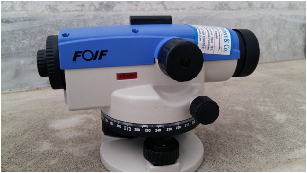
1. Automatic Level Machine
Automatic level is an optical instrument used to establish or verify points in the same horizontal plane. It is used in surveying and building with a vertical staff to measure height differences and to transfer, measure and set heights.
The level instrument is set up on a tripod and, depending on the type, either roughly or accurately set to a leveled condition using foot screws (leveling screws). The operator looks through the eyepiece of the telescope while an assistant holds a tape measure or graduated staff vertical at the point under measurement. The instrument and staff are used to gather and/or transfer elevations (levels) during site surveys or building construction. Measurement generally starts from a benchmark with known height determined by a previous survey, or an arbitrary point with an assumed height.
An Auto Level is a Professional Leveling Tool used by Contractors, Builders, Land Surveying Professionals, or the Engineer who demands accurate leveling every time. Auto Levels set up fast, are easy to use, and save time and money on every job.
It covers the following topics:
- Carrying of road alignment project
- Carrying of canal alignment project
- Carrying of drainage alignment project
- Shifting of benchmark (fly leveling)
- To complete cross sectional and longitudinal surveys
- To determine the design levels
Figure: Automatic Level Machine
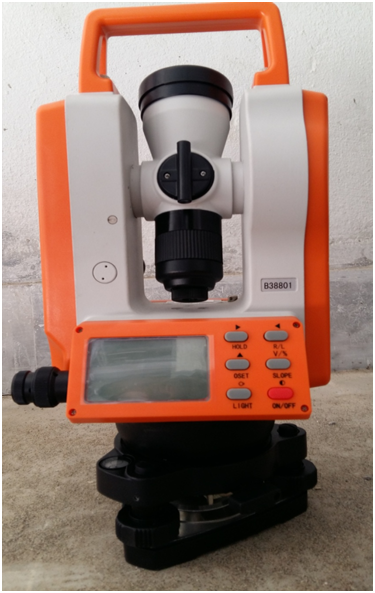
2. Theodolite Machine
A theodolite is a precision instrument for measuring angles in the horizontal and vertical planes. Theodolites are used mainly for surveying applications, and have been adapted for specialized purposes in fields like metrology and rocket launch technology. A modern theodolite consists of a movable telescope mounted within two perpendicular axes the horizontal axis, and the vertical axis. When the telescope is pointed at a target object, the angle of each of these axes can be measured with great precision.
A theodolite works by combining optical plummets (or plumb bobs), a spirit (bubble level), and graduated circles to find vertical and horizontal angles in surveying. An optical plummet ensures the theodolite is placed as close to exactly vertical above the survey point. The internal spirit level makes sure the device is level to the horizon. The graduated circles, one vertical and one horizontal, allow the user to actually survey for angles.
It covers the following topics:
- Triangulation survey
- Carrying of road alignment project
- Area measurement
- To find out horizontal angles
- To find out vertical angles
- To plot traverse
- To set out curves
- To draw contour maps
- Meteorology
- Laying out building corners and lines
- Measuring and laying out angles and straight lines
- Plumbing a column or building corner
- Ranging
- Leveling
- Optical distance measurement
- Controlling verticality
Figure: Theodolite Machine
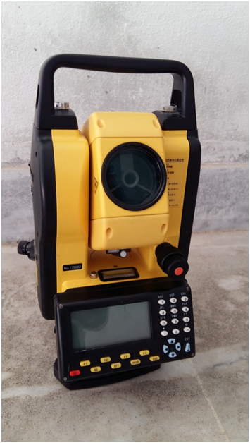
3. Total station
A total station or TST (total station theodolite) is an electronic/optical instrument used in modern surveying and building construction. The total station is an electronic theodolite (transit) integrated with an electronic distance measurement (EDM) to read slope distances from the instrument to a particular point, and an on-board computer to collect data and perform advanced coordinate based calculations.
It covers the following topics:
- Slope Staking
- Topographic surveys
- Construction project layout
- Building corners
- Control and offset lines
- Leveling
- Traverse surveys and adjustments
- Building Face Surveys
- Resections
- Areas Intersections
- Point Projections
- Taping from Baseline
- Road (Highway) Surveys
Figure: Total Station